FSU climatologists: La Niña may bring warm late winter to Southeast

After interference from an unexpected climate event, La Niña is expected to re-establish her influence over weather patterns in the Southeast and bring warm and dry weather to the region for the rest of the winter, according to officials at the Florida Climate Center at The Florida State University.
So far, the Southeast has experienced an extremely cold winter, a surprise since La Niña usually brings warm temperatures to the Sunshine State and its neighbors. So, what happened?
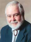
"There is another ocean-driven actress in the house called NAO — The North Atlantic Oscillation, or the Arctic Oscillation," said James O'Brien, emeritus Robert O. Lawton Distinguished Professor and former state climatologist of Florida. NAO is an indicator of the jet stream pattern over the Eastern United States and the North Atlantic.
"The ocean between Canada and Greenland was very cold, creating a blocking high pressure system," O'Brien said. "As a result, the Atlantic winter storms stayed further south over the Gulf Stream extension and got very strong. Their backside pulled very cold air down from Canada all the way to Florida."
While El Niño and La Niña can be predicted six months in advance, NAO changes are not yet predictable on seasonal time scales, which poses problems for seasonal forecasts in general and winter temperatures in particular, according to David Zierden, state climatologist of Florida and climate scientist at the Florida Climate Center. Researchers are actively working on models that may eventually better predict the NAO shifts.
Seeing a fast transition from an El Niño phase to La Niña in July 2010, the Climate Center and others last fall predicted dry weather and warm temperatures this winter. El Niño refers to a periodic warming of the tropical Pacific Ocean along the equator from the coast of South America to the central Pacific that generally brings cooler and wetter winter and springs to the southeastern United States. La Ninã is the opposite phase caused by a cooling of the tropical Pacific Ocean and normally brings drier and warmer winter and springs to the Southeast.
Without knowing about the NAO, climatologists were only half right: While Florida is experiencing dry conditions, the statewide temperature for December in Florida was more than 9 degrees Fahrenheit below the 20th century average, according to Clyde Fraisse, climate extension specialist with the University of Florida and a key partner in the Florida Climate Center's work with the Southeast Climate Consortium.
The NOAA National Climatic Data Center (NCDC) has determined that December 2010 was the coldest December on record for Florida, and several cities within the state, including Miami, West Palm Beach, Fort Lauderdale, Daytona, Orlando, Tampa and Tallahassee, experienced record cold temperatures in December.
But there is good news on the way. Medium-range weather prediction models are forecasting a break from this negative NOA pattern, which would allow the strong La Niña to re-establish its influence over the weather patterns in the Southeast.
"Warmer and continued dry weather is still the best forecast for the remainder of the winter and the transition to spring in the Southeast," O'Brien said.

"Warmer and continued dry weather is still the best forecast for the remainder of the winter and the transition to spring in the Southeast."
James O'Brien
Emeritus Robert O. Lawton Distinguished Professor
